Most couples choose a Mexican Caribbean wedding destination from photographs. Your guests will experience it as a journey: a flight, an arrival hall, a transfer, sometimes a ferry, and only then the view.
That is why we start every destination conversation with geography. Cancun, Costa Mujeres, Playa del Carmen and Tulum can look alike on Instagram, yet they sit at very different distances from the airport most U.S. guests will use. An island adds a boat. A boutique hotel south of Tulum can add another half hour of road after a full travel day.
This guide explains how the coast is laid out, what official sources say about travel times, and how to use the Mexican Caribbean Destination & Wedding Explorer, the free 3D map we built so couples can see all of it before choosing.
The short answer
Where is everything, and how do guests get there?
- Cancun International Airport (CUN) sits at the north end of the coast and is the arrival point for most of it. The Quintana Roo Tourism Board puts the Hotel Zone and Puerto Morelos about 20 minutes away, Costa Mujeres about 40 minutes and Playa del Carmen about 45 minutes.
- The Riviera Maya is the stretch of coast from Puerto Morelos to Tulum, which the Tourism Board describes as about seventy-five miles long. Cancun sits north of it.
- Tulum is about 128 km (80 miles) south of Cancun, according to Mexico's national institute of archaeology (INAH), and has its own airport (TQO), which the Tourism Board places about 25 minutes from town.
- Isla Mujeres, Cozumel and Holbox add a ferry. Cozumel also has its own airport.
- The Maya Train stations are inland, not on the beach, so guests still need a transfer at each end.
Open the map before you open a resort brochure
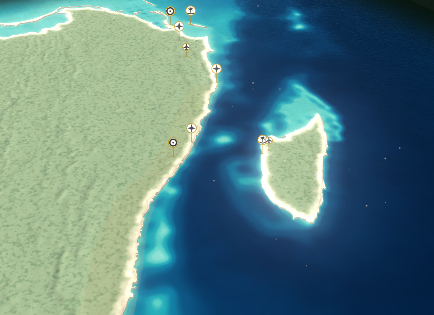
Mexican Caribbean Destination & Wedding Explorer
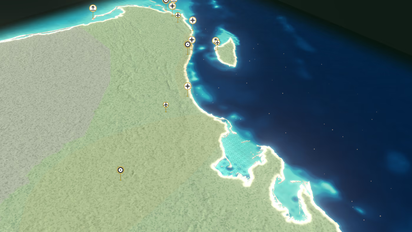
- 14 destinations on a 3D map of the real coastline, from Holbox to Chetumal
- Layers for airports, ferries, Maya Train stations, beaches, reefs, Maya sites and nature areas
- Compare up to three destinations side by side
- Four questions in “Find my destination” to narrow the list
- A written guide to every destination below the map
It is free, works in any modern browser and needs no sign-up. On a phone, the map fills the screen and each destination opens in a sheet you can drag up to read. On a laptop you can zoom with the trackpad or mouse wheel and switch layers on and off.
Two things it deliberately does not do: it does not calculate road routes or show live ferry, train or flight schedules, and it does not map every resort. It shows a curated sample of hotels and restaurants alongside the destinations, airports, ferries and train stations. Distances inside the tool are straight-line distances, clearly labelled, because road times change with traffic, construction and the hour you land.
How the coast is laid out, north to south
Think of the Mexican Caribbean as one long coastline running south from the tip of the Yucatan Peninsula, with three islands offshore and Highway 307 tying the mainland together.
Cancun and Costa Mujeres: the north
Cancun's Hotel Zone is the long strip between the sea and the lagoon, minutes from the airport. North of it, Costa Mujeres (also marketed as Playa Mujeres) is a newer stretch of large resorts; see our Costa Mujeres wedding resorts. The Tourism Board says it begins where the Hotel Zone ends, about forty minutes by road from the airport. See Costa Mujeres on the map.
Costa Mujeres is not Isla Mujeres
Costa Mujeres is on the mainland: no boat needed. Isla Mujeres is an island about nine miles off Cancun, reached by ferry. The names confuse guests every season, so spell it out on your wedding website.
The Riviera Maya: Puerto Morelos to Tulum
The Tourism Board defines the Riviera Maya as the coast “from Puerto Morelos to Tulum.” It is a corridor rather than a city: the fishing-village calm of Puerto Morelos, the resort and nightlife hub of Playa del Carmen, the gated communities and resorts of Playacar, Puerto Aventuras and Akumal, then Tulum. Where you stay matters more than the name on the brochure, because the two ends are more than an hour apart by road.
If you are still choosing between the big three, our Cancun vs Riviera Maya vs Tulum comparison covers atmosphere, privacy and complexity. This guide stays with the geography.
Tulum and the south
Tulum combines a town, a beach hotel zone and the archaeological site above the sea. South of it lie Sian Ka'an and the Maya Ka'an region, then Bacalar's lagoon, Mahahual on the Costa Maya and Chetumal on the border with Belize. These are beautiful and quieter, and they ask more of guests' travel time. The Explorer covers all of them.
The islands
Isla Mujeres sits off Cancun, Cozumel off Playa del Carmen, and Holbox off the northern tip near Chiquila. Each one changes the weekend: guests plan around ferry departures, luggage goes on a boat, and late-night returns need thought.
From the airport to each wedding area
Distances published online disagree, mostly because few sources say which “Cancun” they measure from: the airport, downtown or the Hotel Zone. The table below measures from Cancun International Airport and separates two kinds of figure. Travel times are the official estimates published by the Quintana Roo Tourism Board, quoted as written. Road distances are approximate, calculated with OpenStreetMap routing on 16 October 2026; real drive times depend on traffic and the hour of arrival.
| Wedding area | Official travel time | Approx. road distance | Ferry? |
|---|---|---|---|
| Cancun Hotel Zone | About 20 minutes | 16 mi (26 km) to mid-Hotel Zone | No |
| Puerto Morelos | About 20 minutes, “the shortest run in the whole Riviera Maya” | 16 mi (25 km) | No |
| Costa Mujeres | About 40 minutes by road | 18 mi (29 km) | No |
| Playa del Carmen | About 45 minutes on Highway 307 | 33 mi (54 km) | No |
| Puerto Aventuras | No official estimate published | 47 mi (76 km) | No |
| Akumal | No official estimate published | 56 mi (90 km) | No |
| Tulum town | From CUN: no official estimate. Tulum is 128 km south of Cancun (INAH) | 72 mi (116 km) | No |
| Isla Mujeres | Road to the ferry, then about 20 minutes by boat from Puerto Juarez | 14 mi (23 km) to Puerto Juarez | Yes |
| Cozumel | Fly to Cozumel airport, or road to Playa del Carmen plus about 45 minutes by ferry | 33 mi (54 km) to Playa del Carmen | Yes, or fly |
| Holbox | About two hours by road to the port of Chiquila, then about 25 minutes by ferry | 85 mi (137 km) to Chiquila | Yes |
Official times are the Tourism Board's own phrases and assume ordinary conditions. We have not published drive minutes where no official figure exists: build your guest timeline with your transfer provider, and add margin for arrival-day immigration and baggage queues.
What the distances mean for a wedding weekend
- Arrival day is a travel day. If most guests land mid-afternoon and the transfer runs an hour or more, a welcome dinner that same evening becomes a rush. Many couples hold the welcome event on the second night for that reason.
- Group transfers beat taxis. Pre-arranged transfers keep a group together, handle luggage and give older guests certainty. They also make the shuttle schedule part of your plan rather than a guest's problem.
- Off-site events double the distance question. A rehearsal dinner in Playa del Carmen for guests staying in Tulum means two long road legs in one evening.
Cancun (CUN) or Tulum (TQO)?
Cancun International is the region's main gateway, run by the airport group ASUR, which also runs Cozumel's airport. Tulum International Airport “Felipe Carrillo Puerto” opened in December 2023. Its federal decree places it on Highway 307 at kilometer 201, south of Tulum, and the Tourism Board describes it as about twenty-five minutes from town.
For a wedding in Tulum, TQO can shorten the final leg considerably. The catch is choice: U.S. routes into Tulum have changed more than once since it opened, and airlines adjust them seasonally. For a group arriving from many cities, Cancun usually offers more options and more daily flights.
Our advice for Tulum weddings
Give guests both airports on your wedding website and let them compare flights from their own city. Then plan transfers from each, rather than assuming everyone lands in the same place. Airline routes change too often for any guide, including this one, to promise a nonstop.
Island weddings: Isla Mujeres, Cozumel and Holbox
An island wedding can be magical, and it is entirely workable when the ferry is planned like a vendor rather than an afterthought.
Isla Mujeres
About nine miles off Cancun. The Tourism Board puts the passenger ferry from Puerto Juarez at roughly twenty minutes, with frequent departures. Hotel Zone piers at Playa Tortugas, Playa Caracol and El Embarcadero take longer and sail less often. Vehicles cross from Punta Sam. Isla Mujeres on the map.
Cozumel
Two ways in: fly directly to Cozumel's own airport, which the Tourism Board places about ten minutes from San Miguel, or take a passenger ferry from the terminal at the foot of Fifth Avenue in Playa del Carmen, about forty-five minutes. Vehicles use a separate terminal south of Playa. Cozumel on the map or browse Cozumel wedding resorts.
Holbox
The longest journey: about two hours by road from Cancun airport to the port of Chiquila, then about twenty-five minutes by ferry. The island has no private cars and ferries stop running in the late afternoon, so late flights can mean a night on the mainland. Holbox on the map.
What to plan
- Confirm ferry timetables with the operator for your exact dates.
- Check the last departure against your reception end time.
- Arrange luggage help at both terminals for older guests.
- Keep a weather plan: crossings can be suspended in strong wind.
The Maya Train: useful, but not door to door
The Tren Maya lists stations at Cancun Airport, Puerto Morelos, Playa del Carmen, Tulum and Tulum Airport, among others in Quintana Roo. It is a real option for adventurous guests, with one important caveat for weddings: the stations sit inland, beside the highway or on the edge of town. The Tourism Board notes that Playa del Carmen's station lies west of the city, outside the center, and Tulum's lies west of town.
Cancun Airport station is not inside the terminals, and none of the stations are in a hotel zone or on a beach. Guests with wedding luggage still need a transfer at both ends.
Train routes and timetables have changed several times during 2026. Check the official Tren Maya timetable close to your dates rather than relying on any published schedule, including older guides.
How to use the map to shortlist your wedding area
-
Five minutes
Turn on the Wedding Context layer
It colors each destination by how simple guest arrival is. Then switch on Airports and Ferries to see why.
-
Ten minutes
Answer “Find my destination”
Four questions about the experience you want, how much easy access matters, the setting and your guests. It suggests two to four destinations that fit your answers.
-
Fifteen minutes
Compare your top three
Compare sets up to three destinations side by side on getting there, the experience and wedding context, rated in words rather than scores, with the practical airport and whether a ferry is involved.
-
Then
Send each other a link
Every destination has its own address. Share the Tulum view, Playa del Carmen, Cancun or Puerto Morelos with your partner or family, or jump straight to the written getting-there notes for Tulum.
The shortlist inside the tool saves up to four destinations in your own browser, with no account. When you have two or three areas, our destination guides for Cancun, the Riviera Maya and Tulum go deeper into venues and guest experience, and the best time to marry guide covers season, heat and storms.
Mexican Caribbean map and travel questions
INAH places Tulum about 128 km (80 miles) south of Cancun. By road from Cancun International Airport to Tulum town it is roughly 116 km (72 miles) along Highway 307, based on OpenStreetMap routing. Drive time depends on traffic and where in Tulum you stay, so plan it with your transfer provider.
The Quintana Roo Tourism Board says the airport is about forty-five minutes from Playa del Carmen along federal Highway 307. The road distance is roughly 54 km (33 miles). Allow extra time for immigration, baggage and traffic on arrival day.
Tulum International Airport (TQO) is closer to Tulum, about twenty-five minutes from town according to the Tourism Board, while Cancun International (CUN) usually offers more flights. U.S. routes into Tulum have changed several times, so guests should compare flights into both airports from their own city before booking.
No. Costa Mujeres is on the mainland north of Cancun's Hotel Zone, about forty minutes by road from the airport, with no ferry. Isla Mujeres is an island about nine miles off Cancun, reached by a passenger ferry of roughly twenty minutes from Puerto Juarez.
No. The Quintana Roo stations are inland, beside the highway or on the edge of town, and the Cancun Airport station is outside the terminals. Guests still need a transfer at each end. Check the official Tren Maya timetable close to your dates, because service has changed during 2026.
In two legs: about two hours by road from Cancun airport to the port of Chiquila, then about twenty-five minutes by ferry, according to the Tourism Board. Ferries stop in the late afternoon and the island has no private cars, so guests on late flights may need a night on the mainland.
No. The Explorer maps 14 destinations with their airports, ferries, train stations, beaches, reefs and heritage sites, plus a curated sample of hotels and restaurants. It is a planning map for choosing an area, not a booking engine or a full resort directory.
From map to plan
Found two areas you love? Let us show you how the weekend would really flow.
We plan destination weddings and manage guest travel across this coast. Tell us your shortlist and guest count, and we will compare arrival logistics, venues and room blocks for each area.
Keep planning



Sources
- Quintana Roo Tourism Board: Cancun, Costa Mujeres, Puerto Morelos, Playa del Carmen, Riviera Maya, Tulum, Isla Mujeres, Cozumel and Holbox (accessed October 16, 2026)
- INAH: Tulum archaeological zone (location and distance from Cancun)
- ASUR: airports operated, including Cancun and Cozumel
- Diario Oficial de la Federacion: decree for Tulum International Airport “Felipe Carrillo Puerto”
- Tren Maya: official site, stations and timetable
- Ultramar: Isla Mujeres ferry terminals and Winjet: Playa del Carmen and Cozumel docks
- Approximate road distances: OpenStreetMap data routed with OSRM, calculated October 16, 2026. Map data © OpenStreetMap contributors.